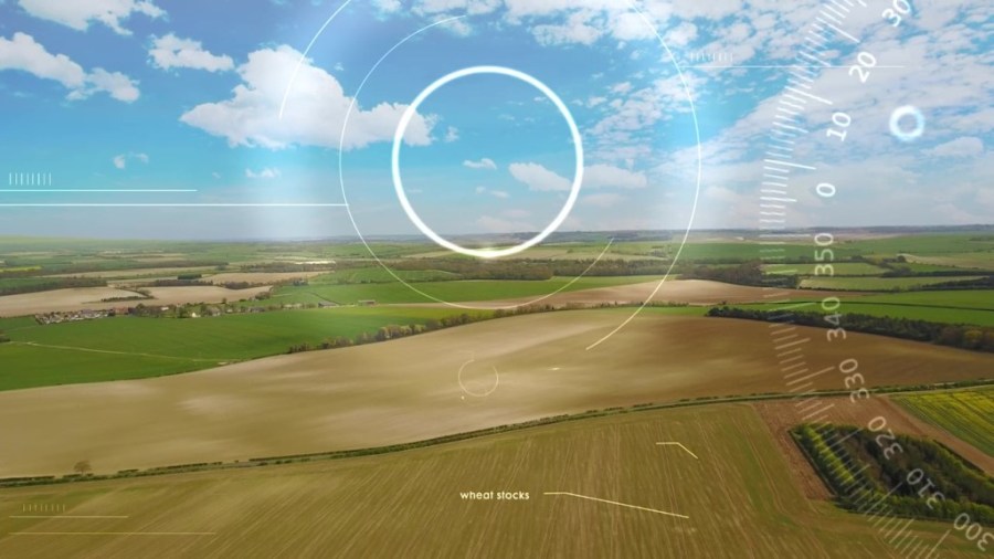
A powerful new web-based service has been launched, giving farmers free access to daily satellite information on the growth of their crops and will even predict the yield. CPM takes it for a test run.
By Tom Allen-Stevens
Access to quite a remarkable amount of data about your farm and your crop is now available free of charge for the 2018 season following the launch of Contour from Intelligent Precision Farming (IPF) and Agrii’s SoilQuest.
The new service, as highlighted in CPM, brings in data from the Sentinel radar satellites, hyper local weather (data specific to your farm, including soil temperature and moisture levels, from a range of sources) and daily optical satellite data.
We’ve now taken it for a test drive and reckon it really does provide useful access to a wealth of data you probably never realised was possible to gather, and delivers it on a platform that’s remarkably easy to navigate.
To sign up for the service, you click through to the Contour site and fill in the online form, adding a map of your farm.
Once your account has been opened, you’ll be able to login, and this presents you with the dashboard.
You get access to weather data from the last 100 days, including rainfall and soil moisture.
It calculates this by using data from the nearest weather station, then pinpoints a central location on your farm and interpolates the data, using weather, radar and satellite data.
Leaf wetness and field accessibility
Useful criteria here are leaf wetness and field accessibility – it uses the weather model to predict these for the next seven days.
This means you can plan when to apply the blackgrass herbicide or start the early nitrogen dressing, for example. A detailed view of today gives you wind speed, etc.
Looking through the history, as well as the prediction, is informative too – soils for the Oxon farm we looked at in Dec and Jan were clearly warmer on occasions than normal.
This may explain how crops have managed to progress over the last two months, although the forecast for early Feb looks pretty cold and static.
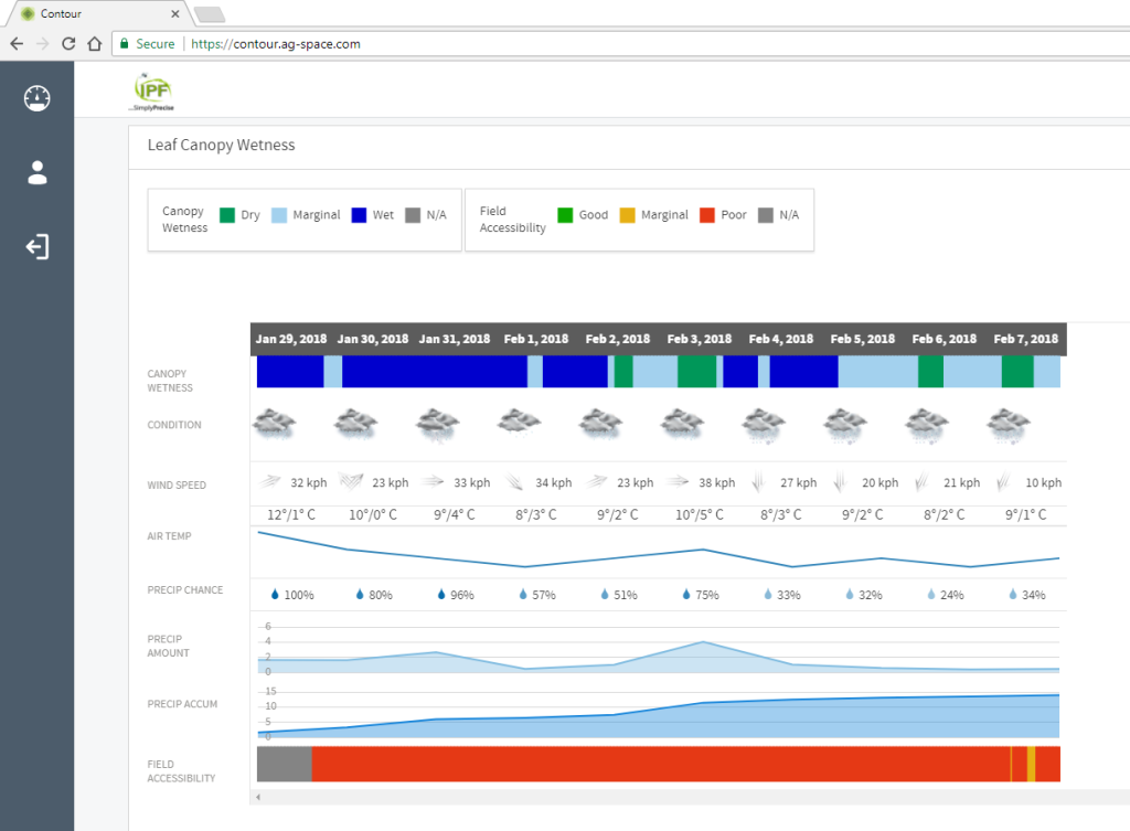
It uses the weather model to predict useful criteria such as leaf wetness and field accessibility.
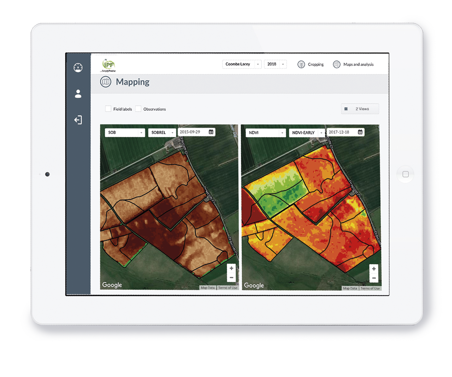
The really clever bit is when you look at the data it’s compiled for your fields – you need to tell the software the crop, sowing date and estimated yield (for NVZ purposes) for each of your fields.
You get the latest NDVI data down to 3.5m resolution. This was about 10 days old for us, but it’s updated daily with SAR (Synthetic Aperture Radar) and other information.
That brings information on a field-by-field basis on growth stage, green area index and biomass.
Early N recommendations
We could see from this the extent of pigeon damage in some of the oilseed rape fields – GAI varied from 0.3 to 1.9, which is a good basis for the early N recommendations.
Interestingly, it also picked out fields we thought had the same crop cover, but differed enough for us to want to tweak that N rate.
This information is all part of the free service, although you can subscribe to various elements of the IPF service if you want variable rate application maps, for example.
Soil brightness
You can also get soil brightness information, down to a 3.5m resolution. This is essentially snapshots of your field at drilling and then soon after.
The data gives you a remarkably accurate picture of how soil type varies across fields – again, you can subscribe to IPF’s soil zoning service to make more use of it.
Soil brightness data brings you snapshots of your field at drilling and then soon after.
Coming on later this spring, as soon as crops have progressed enough, will be the yield prediction, which is also part of the free service.
This will accurately tell you what each field will yield, based on current biomass and clever modelling software that’s been found to be accurate to within 10%.
Totals by crop type will inform marketing decisions as the season progresses. The model takes account of odd weather events as they occur, and adjusts accordingly.
Perhaps the most interesting aspect is that you can see how each field is progressing – predictions adjust daily, so you can use it to tweak planned fungicide inputs or prioritise fields for key applications.
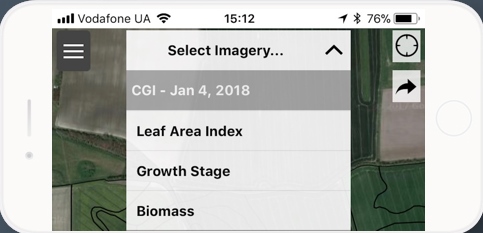
You can also access the data through a smartphone.
Any UK farmer can sign up for free for the 2018 season, using the IPF portal, or via Soilquest.
Those who wish to continue will pay £2/ha per year for daily satellite images, hyper local weather, growth stage prediction, GAI data and yield prediction.
Various services like precision soil analysis and precision fertiliser plans from IPF can be loaded on top, adding an extra £1.60 – 5.80/ha.